Wednesday, February 29, 2012

NASA Satellite Finds Earth's Clouds are Getting Lower

0 comments
NASA Satellite Finds Earth's Clouds are Getting Lower
Earth's clouds got a little lower -- about one percent on average -- during the first decade of this century, finds a new NASA-funded university study based on NASA satellite data. The results have potential implications for future global climate.

Scientists at the University of Auckland in New Zealand analyzed the first 10 years of global cloud-top height measurements (from March 2000 to February 2010) from the Multi-angle Imaging SpectroRadiometer (MISR) instrument on NASA's Terra spacecraft. The study, published recently in the journal Geophysical Research Letters, revealed an overall trend of decreasing cloud height. Global average cloud height declined by around one percent over the decade, or by around 100 to 130 feet (30 to 40 meters). Most of the reduction was due to fewer clouds occurring at very high altitudes.

Lead researcher Roger Davies said that while the record is too short to be definitive, it provides a hint that something quite important might be going on. Longer-term monitoring will be required to determine the significance of the observation for global temperatures.

A consistent reduction in cloud height would allow Earth to cool to space more efficiently, reducing the surface temperature of the planet and potentially slowing the effects of global warming. This may represent a "negative feedback" mechanism – a change caused by global warming that works to counteract it. "We don't know exactly what causes the cloud heights to lower," says Davies. "But it must be due to a change in the circulation patterns that give rise to cloud formation at high altitude."

Thursday, February 23, 2012

The Sun As Art

0 comments
The Sun As Art

A new interactive NASA art exhibit opens February 9 at the Maryland Science Center in Baltimore that will showcase stunning images of the sun.

Called "Sun As Art," the collection consists of 20 full-color, high-resolution images of the star with which we live. Some of the pieces stand alone, beautiful images that hold true to the original picture. Others have been modified: one looks like an Andy Warhol painting; another like an orange. Several pieces in the collection have an interactive component where visitors using smart phones can scan a QR code and watch the particular solar event that inspired the finished image.

The exhibit is the brainchild of Dr. Steele Hill, a media specialist at NASA's Goddard Space Flight Center in Greenbelt, Md. Hill selected images from some of the agency's solar missions to showcase incredible details of the sun in a unique way.

Thursday, February 16, 2012

NASA Mission Returns First Video From Moon's Far Side

0 comments

A camera aboard one of NASA's twin Gravity Recovery And Interior Laboratory (GRAIL) lunar spacecraft has returned its first unique view of the far side of the moon. MoonKAM, or Moon Knowledge Acquired by Middle school students, will be used by students nationwide to select lunar images for study.

GRAIL consists of two identical spacecraft, recently named Ebb and Flow, each of which is equipped with a MoonKAM. The images were taken as part of a test of Ebb's MoonKAM on Jan. 19. The GRAIL project plans to test the MoonKAM aboard Flow at a later date.

In the video, the north pole of the moon is visible at the top of the screen as the spacecraft flies toward the lunar south pole. One of the first prominent geological features seen on the lower third of the moon is the Mare Orientale, a 560-mile-wide (900 kilometer) impact basin that straddles both the moon's near and far side.

The clip ends with rugged terrain just short of the lunar south pole. To the left of center, near the bottom of the screen, is the 93-mile-wide (149 kilometer) Drygalski crater with a distinctive star-shaped formation in the middle. The formation is a central peak, created many billions of years ago by a comet or asteroid impact.

"The quality of the video is excellent and should energize our MoonKAM students as they prepare to explore the moon," said Maria Zuber, GRAIL principal investigator from the Massachusetts Institute of Technology in Cambridge.

The twin spacecraft successfully achieved lunar orbit this past New Year's Eve and New Year's Day. Previously named GRAIL-A and GRAIL-B, the washing machine-sized spacecraft received their new names from fourth graders at the Emily Dickinson Elementary School in Bozeman, Mont., following a nationwide student naming contest.

Thousands of fourth- to eighth-grade students will select target areas on the lunar surface and send requests to the GRAIL MoonKAM Mission Operations Center in San Diego. Photos of the target areas will be sent back by the satellites for students to study. The MoonKAM program is led by Sally Ride, America's first woman in space. Her team at Sally Ride Science and undergraduate students at the University of California in San Diego will engage middle schools across the country in the GRAIL mission and lunar exploration. GRAIL is NASA's first planetary mission carrying instruments fully dedicated to education and public outreach.

"We have had great response from schools around the country; more than 2,500 signed up to participate so far," Ride said. "In mid-March, the first pictures of the moon will be taken by students using MoonKAM. I expect this will excite many students about possible careers in science and engineering."

Launched in September 2011, Ebb and Flow periodically perform trajectory correction maneuvers that, over time, will lower their orbits to near-circular ones with an altitude of about 34 miles (55 kilometers). During their science mission, the duo will answer longstanding questions about the moon and give scientists a better understanding of how Earth and other rocky planets in the solar system formed.

NASA's Jet Propulsion Laboratory in Pasadena, Calif., manages the GRAIL mission for NASA's Science Mission Directorate in Washington. The GRAIL mission is part of the Discovery Program managed at NASA's Marshall Space Flight Center in Huntsville, Ala. Lockheed Martin Space Systems in Denver built the spacecraft.

Monday, February 13, 2012

NASA Mission Takes Stock of Earth's Melting Land Ice

0 comments
In the first comprehensive satellite study of its kind, a University of Colorado at Boulder-led team used NASA data to calculate how much Earth's melting land ice is adding to global sea level rise.

Using satellite measurements from the NASA/German Aerospace Center Gravity Recovery and Climate Experiment (GRACE), the researchers measured ice loss in all of Earth's land ice between 2003 and 2010, with particular emphasis on glaciers and ice caps outside of Greenland and Antarctica.

The total global ice mass lost from Greenland, Antarctica and Earth's glaciers and ice caps during the study period was about 4.3 trillion tons (1,000 cubic miles), adding about 0.5 inches (12 millimeters) to global sea level. That's enough ice to cover the United States 1.5 feet (0.5 meters) deep.

"Earth is losing a huge amount of ice to the ocean annually, and these new results will help us answer important questions in terms of both sea rise and how the planet's cold regions are responding to global change," said University of Colorado Boulder physics professor John Wahr, who helped lead the study. "The strength of GRACE is it sees all the mass in the system, even though its resolution is not high enough to allow us to determine separate contributions from each individual glacier."

About a quarter of the average annual ice loss came from glaciers and ice caps outside of Greenland and Antarctica (roughly 148 billion tons, or 39 cubic miles). Ice loss from Greenland and Antarctica and their peripheral ice caps and glaciers averaged 385 billion tons (100 cubic miles) a year. Results of the study will be published online Feb. 8 in the journal Nature.

Traditional estimates of Earth's ice caps and glaciers have been made using ground measurements from relatively few glaciers to infer what all the world's unmonitored glaciers were doing. Only a few hundred of the roughly 200,000 glaciers worldwide have been monitored for longer than a decade.

One unexpected study result from GRACE was the estimated ice loss from high Asian mountain ranges like the Himalaya, the Pamir and the Tien Shan was only about 4 billion tons of ice annually. Some previous ground-based estimates of ice loss in these high Asian mountains have ranged up to 50 billion tons annually.

"The GRACE results in this region really were a surprise," said Wahr, who also is a fellow at the University of Colorado-headquartered Cooperative Institute for Research in Environmental Sciences. "One possible explanation is that previous estimates were based on measurements taken primarily from some of the lower, more accessible glaciers in Asia and extrapolated to infer the behavior of higher glaciers. But unlike the lower glaciers, most of the high glaciers are located in very cold environments and require greater amounts of atmospheric warming before local temperatures rise enough to cause significant melting. This makes it difficult to use low-elevation, ground-based measurements to estimate results from the entire system."

"This study finds that the world's small glaciers and ice caps in places like Alaska, South America and the Himalayas contribute about .02 inches per year to sea level rise," said Tom Wagner, cryosphere program scientist at NASA Headquarters in Washington. "While this is lower than previous estimates, it confirms that ice is being lost from around the globe, with just a few areas in precarious balance. The results sharpen our view of land ice melting, which poses the biggest, most threatening factor in future sea level rise."

The twin GRACE satellites track changes in Earth's gravity field by noting minute changes in gravitational pull caused by regional variations in Earth's mass, which for periods of months to years is typically because of movements of water on Earth's surface. It does this by measuring changes in the distance between its two identical spacecraft to one-hundredth the width of a human hair.

Thursday, February 9, 2012

Astronomy team discovers nearby dwarf galaxy

0 comments
Astronomy team discovers nearby dwarf galaxyNGC 4449 has a nucleus that may someday host a black hole and an irregular structure, lacking the spiral arms characteristic of many galaxies, he said. It is surrounded by a huge complex of hydrogen gas that spans approximately 300,000 light years, which may be fueling its burst of star formation.

Rich collaborated with Francis Longstaff, a professor of finance at the UCLA Anderson School of Management and an amateur astronomer, in acquiring and using a specialized telescope designed to take images of wide fields of the sky. Known as the Centurion 28 (the diameter of the mirror is 28 inches), the telescope, and the observatory the astronomers used, are located at the Polaris Observatory Association near Frazier Park, in Kern County, Calif.

With the C28 telescope, the astronomers discovered the companion dwarf galaxy, which has "evidently experienced a close encounter with the nucleus of NGC 4449," Rich said. Dubbed NGC 4449B, the dwarf galaxy has been stretched into a comet-like shape by this gravitational encounter.

NGC 4449B had remained undetected because it is more than 10 times fainter than the natural brightness of the night sky and some 1,000 times fainter than our own Milky Way galaxy. The dwarf galaxy is in a "transient stage," Rich said, and will soon — by astronomical standards — be dissolved.

The Milky Way has a similar companion, known as the Sagittarius Dwarf galaxy, which has been wrapped around our galaxy as it orbits and which loses its stars to the Milky Way's gravitational tug.


Thursday, February 2, 2012

Powerful Pixels: Mapping the "Apollo Zone"

0 comments
Apollo Zone
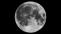
Grayscale pixels – up close, they look like black, white or grey squares. But when you zoom out to see the bigger picture, they can create a digital photograph, like this one of our moon:

For NASA researchers, pixels are much more – they are precious data that help us understand where we came from, where we've been, and where we're going.

At NASA's Ames Research Center, Moffett Field, Calif., computer scientists have made a giant leap forward to pull as much information from imperfect static images as possible. With their advancement in image processing algorithms, the legacy data from the Apollo Metric Camera onboard Apollo 15, 16 and 17 can be transformed into an informative and immersive 3D mosaic map of a large and scientifically interesting part of the moon.

The "Apollo Zone" Digital Image Mosaic (DIM) and Digital Terrain Model (DTM) maps cover about 18 percent of the lunar surface at a resolution of 98 feet (30 meters) per pixel. The maps are the result of three years of work by the Intelligent Robotics Group (IRG) at NASA Ames, and are available to view through the NASA Lunar Mapping and Modeling Portal (LMMP) and Google Moon feature in Google Earth.

"The main challenge of the Apollo Zone project was that we had very old data – scans, not captured in digital format," said Ara Nefian, a senior scientist with the IRG and Carnegie Mellon University-Silicon Valley. "They were taken with the technology we had over 40 years ago with imprecise camera positions, orientations and exposure time by today’s standards."

The researchers overcame the challenge by developing new computer vision algorithms to automatically generate the 2D and 3D maps. Algorithms are sets of computer code that create a procedure for how to handle certain set processes. For example, part of the 2D imaging algorithms align many images taken from various positions with various exposure times into one seamless image mosaic. In the mosaic, areas in shadows, which show up as patches of dark or black pixels are automatically replaced by lighter gray pixels. These show more well-lit detail from other images of the same area to create a more detailed map.